Saturday, July 27, 2013

Chapter 10


Chapter Ten – Lewis and Clark Senior Style
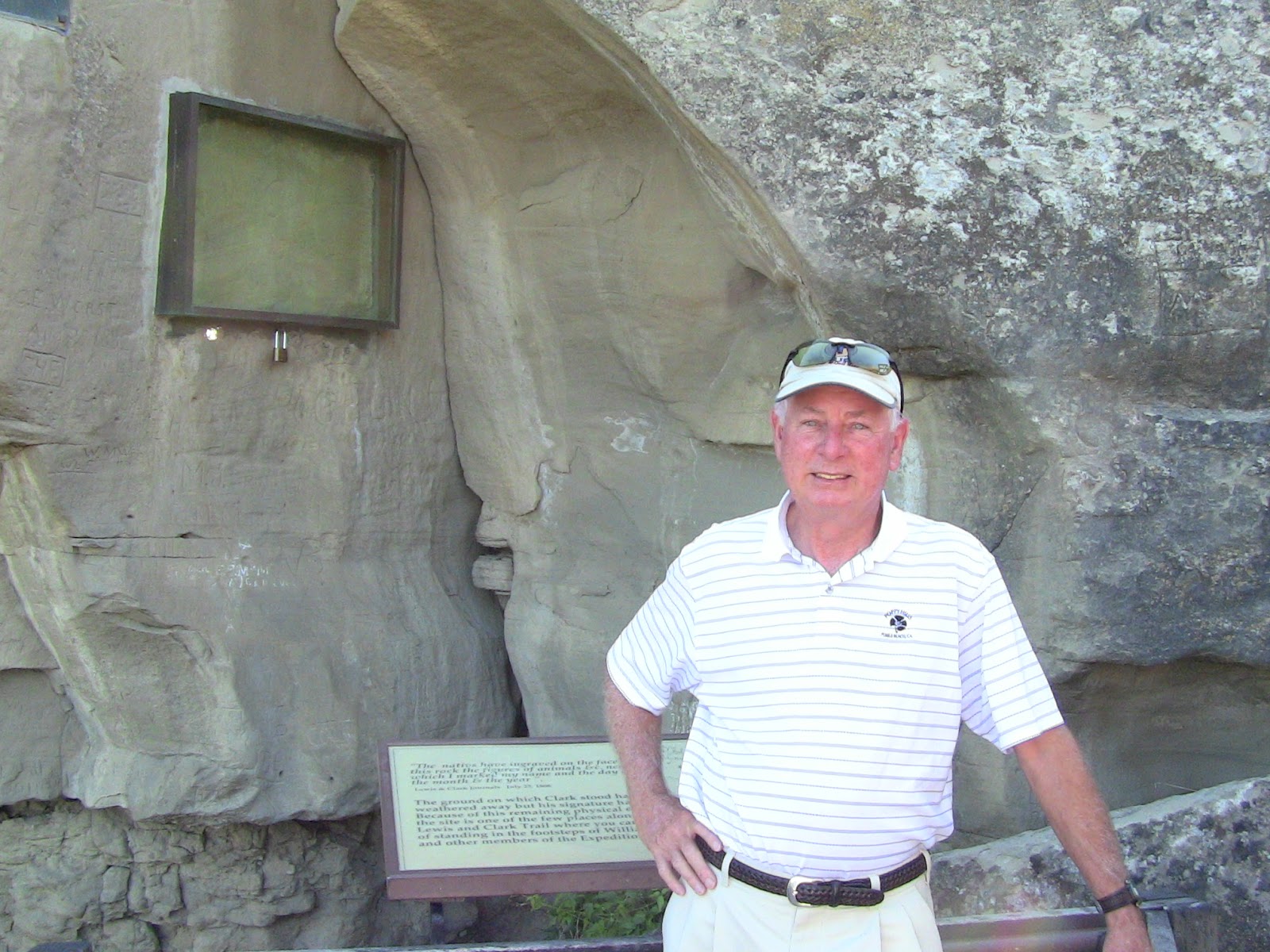
Great Falls – The Portage

Great Falls was an unexpected treat.  Our room was lovely overlooking the Missouri, which was almost blue instead of its normal mud color.  The hotel was across the river from the downtown area, and we decided to walk across the bridge to scout the town on foot.  As we hiked the bridge, a large brick building with a tower dominated the landscape on the other side.  We approached it and read the sign stating it was a restored railroad station.  The doors were locked so we peeked through the windows and determined that the vintage structure was currently being used as an office building.   Russ wanted to ignore the No Trespassing sign at the railroad tracks and walk across them toward town.  I refused and insisted we use the under pass.  As we walked under the tracks, local artists were painting a mural depicting the city’s history on the concrete walls of the underpass.  When we spoke to them, they explained that they were volunteers.  They were painting colorful scenes of buffalo and Native Americans followed by the railroad, the plow and then commerce.  Russ said it must be a metaphor of some sort.

 Downtown Great Falls had the abandoned look of most downtown streets on a Sunday afternoon, plus it was hot.  We walked in one direction through the town to the busy commercial highway where most of the fast food restaurants and small businesses were located, then turned back toward the river through an older neighborhood adjacent to the downtown.  At the river we followed a pedestrian path alongside it and then discovered a lovely park where geese and ducks kept cool in the summer heat.  We passed tables with large families of picnickers enjoying a Sunday afternoon in the shade of aging cottonwood trees.  Everywhere we walked we sensed a tradition of civic pride.  The residents were eating in a downtown park, the artists were enhancing the beauty of their town, and, instead of being leveled, the old railroad station had become a landmark that was in current use.  It was a very pleasant place to visit.

The significance of Great Falls for the Lewis and Clark expedition was that the Corps was forced to spend nearly a month (June 16-July 14, 1805) at the location because five waterfalls impeded their progress by boat.  The Mandan Indians had told the captains about the falls and Lewis and Clark expected to portage one waterfall in a single day.  When Lewis scouted ahead of the Corps, as was his habit, he discovered five waterfalls extending over a distance of ten miles.  He described the first two waterfalls in his journal: 
I continued my rout across the point of a hill a few hundred yards further and was again presented by one of the most beautiful objects in nature, a cascade of about fifty feet perpendicular stretching at right angles across the river . . . to the distance of at least a quarter of a mile.  Here the river pitches over a shelving rock, with an edge as regular and as straight as if formed by art, without a niche or brake in it; the water descends in one even and uninterrupted sheet to the bottom where dashing against the rocky bottom rises into foaming billows of great high and rapidly glides away,   hissing flashing and sparkling as it departs the spray rises from one extremity to the other to 50 f.  I now thought that if a skillful painter had been asked to make a beautiful cascade that he would most probably have presented the precise image of this one; nor could I for some time determine on which of those two great cataracts to bestow the palm, on this or that which I had discovered yesterday; at length I determined between these two great rivals for glory that this was pleasingly beautiful, while the other was sublimely grand.
The task of bypassing the waterfalls was enormous for the Corps.

In addition to the mammoth task of conceiving a plan for portaging the falls, Lewis and Clark were acting as Sacajawea’s physicians.  She had become deathly ill in the days prior to the portage, and while Lewis explored the falls, Clark was treating her symptoms, including bleeding her.  (The Corps hadn’t reached the Shoshone tribe yet, and she was essential to their negotiations for horses.)  She refused to take any medicines, and Clark suspected it was due to her husband’s instructions that she rejected treatment.  When Lewis returned from his exploration of the waterfalls, Clark went forward to survey the falls and surrounding area to devise a portage route.  Lewis took over caring for Sacajawea. 

The first challenge facing Clark was to find a location to exit the river that was barricaded by high cliffs on each shore.  He chose a creek as an outlet, which they named Portage Creek, and the men paddled and pulled the boats two miles up the creek, where they dragged them ashore to dry out.  While the boats dried, the men set up Lower Portage Camp and cached some of the equipment.  Next they chopped and hauled in cottonwood logs, using the wood to construct wheeled platforms (i.e. wagons) on which to carry their supplies and six boats.  Clark surveyed and marked an eighteen mile route across the prairie-the easiest and shortest distance he could devise.  The first two miles were up a steep ascension to the plateaus, then sixteen miles across the cactus ridden prairie to the destination camp site they called, obviously, Upper Portage Camp.

As Clark developed the route, Lewis remained with the main body of men and continued to doctor Sacajawea.  He remembered seeing a sulphur springs a short distance from camp and sent several men to fetch the waters for Sacajawea.  After taking the waters Sacajawea felt well enough the next day to get up.  (Possibly the fact that Clark wasn’t bleeding her anymore helped.)  She went out onto the prairie, ate too much of the local roots and became ill again.  Lewis was furious at her husband for not making certain she followed his instructions to avoid eating anything beyond broth.  Lewis repeated the sulphur water treatment and her health once again improved. 

While Sacajawea recovered, the Corps began the ordeal of hauling six boats and their remaining equipment to Upper Portage Camp.  It required four round trips and eleven days to complete the task.  The men were plagued with bad weather including rain squalls, hail and even gale-force winds, not to mention the heat.  (We were in Great Falls at the same time of year, and we can verify the heat they endured).  The men used the high winds to their advantage by putting up sails and catching the breeze to sail the wheeled boats across the prairie.  The heat was so intense that they stripped off their clothing, but were pelleted by a hail storm that left them battered, bleeding and bruised.  The trek was horrendous and the worst experience yet of the journey.  On the last trip from Lower Portage Camp Sacajawea was recovered enough to walk the eighteen mile portage with Jean Baptiste on her back.  Miraculously, the seventeen year old girl had kept the five month old infant alive throughout her illness.

At Upper Portage Camp the Corps spent two weeks repairing the boats and re-constructing the elements of an iron boat (called the experiment).  The experiment was conceived by Lewis and hauled nearly two thousand miles by the Corps.  After the men pieced together the iron boat’s framework, they covered it with elk skins caulked with a homemade water repellent concocted by Lewis, then they put the experiment in the water.  It sank.  Lewis was embarrassed and Clark set off with a small party of men to find logs suitable for the construction of two additional dugout canoes they needed to replace the pirogue they were leaving behind.

Russ and I know all the above facts about the portage because on Monday morning, July 15, we went to the Lewis and Clark Interpretive Center at Giant Springs.  Clark called Giant Springs, “The largest fountain or spring I ever saw”.  Giant Springs was a beautiful spot of flowing water over granite rocks.  Next to it was a fish hatchery with some giant rainbow trout in a display pond.  It was
Giant Springs
 
a lovely hike after which we returned to the center to tour the exhibits, and decided that the Center was the best we had seen up to this point of the trip.  The exhibits traced the expedition from its
beginning to conclusion and did not focus on just the events in Great Falls.  There was also an amazing two story sculpture depicting the men of the Corps dragging one of the boats from the creek to the plateau. 

                                                                 Portage Sculpture

We watched a film on the portage and by the end of our visit were fully educated on all facets of the feat.  Of course, now we had to visit every site in person that played a part in the portage.  Not an easy task when many of the areas are on private land or at the end of long isolated dirt roads over a span of eighteen miles.  We did it though, and it took two days.  We saw all five dammed waterfalls, both ends of Portage Creek, the sulphur springs (sort of), and both lower and upper portage camps. 

Rainbow Falls

View Down River from Rainbow Falls

 
The Great Falls

Lower Portage Camp on Portage Creek

After visiting the center’s exhibits, seeing the movie and driving to and viewing most of the major sites of the portage, we had intense admiration for the fortitude and resourcefulness of Lewis and Clark and the men of the Corps.  The completion of the task was unbelievably Herculean, and they had done it in only a month.  The problem was that the portage had cost them time, which they dearly needed in order to cross the Rockies before the onset of winter. 

Thursday, July 25, 2013

Chapter Nine


Chapter Nine – Lewis and Clark Senior Style
Mutiny and Gate to the Mountains
Our last night in Butte we had a mutiny in our hotel room.  Up to this point I was content to be the Lieutenant and follow Russ as Captain on our trek along Lewis and Clark’s trail.  That night, July 13, I found it necessary to rebel and retake my accustomed position as co-captain.  After our night in the spacious suite in Billings, Russ agreed with me that the comfort of staying in two rooms outweighed the difference in price over the cost of a single room.  The problem was that he was in the habit of booking our rooms just before our arrival in a town.  His system  meant that all the suites were sometimes taken, and he had to settle for a lesser room.  Lieutenant Pacey (me) was not happy with settling.  I wanted those suites even if it meant having to plan ahead.  (OK, I admit it, I am a planner.  Operating spontaneously is not my style.)
Russ already had a suite at Great Falls (our next destination), but despite all his efforts he could not get one in Missoula, the following stop.  “OK,” I said, “that means we need to plan the hotel rooms for the whole rest of the trip.”  Russ replied, “but that doesn’t give me the freedom to change plans.”  My expression must have been firm when I answered, “this searching for a hotel room at the end of each stay is driving me crazy.”  Russ was silent as he continued his hotel search on the Ipad.  Fortunately, we had a lot of “stuff” and I went to the computer and began my own search for hotel suites for the remainder of the trip.  I kept asking him the next stops and how long he planned to stay.  He answered, and I booked one hotel then proceeded to search for the next hotel.  With the exception of one night, I booked us all the way to our family vacation week in Seattle.  I sat back in my chair, content.  I had a plan.  Russ still hadn’t said a word in opposition.  He merely answered my questions.  The man is smart.  He knows a good mutiny when he sees one.

The next morning was July 14 and we were to drive to Great Falls.  Russ had not only planned for us to travel back and forth between Lewis and Clark’s outbound journey and Clark’s homebound route, his trip plan sometimes moved backwards against the Expedition’s chronological calendar.  When we left Butte, we were leaving the Expedition at Lemhi pass just before they crossed the Rockies.  At Great Falls we would visit the site where they were still on the Missouri and had to portage passed five waterfalls.  It didn’t matter.  It was all just history. 
The drive from Butte to Great Falls took us through Helena, then a long stretch of grass lands without a town or even a truck stop.   In his research Russ had discovered a boat ride twenty miles north of Helena called Gates to the Mountains.  A private company had been running the boats through White Rock Canyon since 1896.  Lewis and Clark had passed through the canyon in July of 1805, and Lewis named its entrance Gates to the Mountains (thus the name of the boat ride).   There were no signs advertising the boat ride, but Russ had made note of the turn off that I am not sure the GPS knew existed.  We assumed that once again we would be the lone patrons of this out of the way site.  The turn off lacked a sign indicating we were heading for the boat ride, but a large mobile home coming from the opposite direction happened to turn onto the isolated road just before we got to it.  We followed the RV impatiently as it lumbered slowly down the gravel road we hoped would take us to the boat ride (still no signs).  We were concerned that possibly the boats only ran once or twice a day and feared we might miss the ride all together.   (Those are always the thoughts you have when you are behind a lumbering RV, especially when you can’t see around it.)  After three miles the RV eased left, and we saw a large lake on our right, then a ranch house and finally a building with a sign reading; Gates to the Mountains. The RV chugged to the left to an upper parking lot which we hadn’t seen because the vehicle had blocked our view.  Directly in front of us we saw four empty parking spots with signs that said, “Please save for our Senior Patrons”.  Hey, we were seniors, and Russ quickly grabbed one of the spots, and at last we had cut off the RV.

Worried that we were going to miss the ride, we went into quick action.  We both had to go to the bathroom desperately, and I searched out the restroom while Russ looked for the place to buy tickets.  I was the only woman in the restroom downstairs, then quickly climbed upstairs to find a lone ticket seller and no line and no Russ.  Not sure if I should buy our tickets, I asked the ticket seller if a grey haired man had bought two tickets.  He said a lot of people have bought tickets.  “When is the next boat ride,” I asked.  He pointed to the sign, 11:00am, which was three minutes away.  The boats left every hour from morning to late afternoon.  “You board the boat downstairs,” the ticket seller added.  I dashed back downstairs and there was Russ coming out of the men’s room.  “Do you have the tickets,” I asked.  He raised his hand holding two tickets.  Trees blocked our view of the lake and the boat dock, so when we walked around the tall trees we were surprised to see a line of people waiting for the boat that was pulling into the dock to unload its two dozen passengers.  Where did all these people come from?
About twenty of us piled onto the boat which would easily hold double that number.  There were families, young couples and middle age couples.  How had they heard about this place I wondered, and how had they found it when there had been no signage to advertise it?  For once we were not lone sightseers but amidst a crowd.  The pilot-guide steered the boat away from the dock into the
wide lake.  He pointed to where the river turned south of the lake and explained that further up the river was Hauser Dam, then he steered us in the opposite direction where the river flowed into White Rock Canyon.  Enormous cliffs guarded each side of the canyon entrance.  They were majestic and beautiful, and grew more so as the boat slowly made its way for the two hour ride up then back through the canyon.

On July 19, 1805, Lewis said of the canyon, “This evening we entered the most remarkable cliffs that we have yet seen.  The towering and projecting rocks in many places seem ready to tumble on us…a spot except one of a few yards in extent on which a man could rest the sole of his foot.”  The canyon, abutting the Gates of the Mountains Wilderness, looked just as it did when Lewis and Clark passed through it.  Except for a few tent campers at sites that could only be reached by boat, the canyon was only habited by wild life.  We were viewing nature in one of its most pristine and majestic states.  It was spectacular.


The pilot- guide told the history of the Hilger family, who owned the ranch house we had seen on our approach, and who had run boats up and down the canyon for over a hundred years.  He explained that the cliffs were made of an unusual folded limestone and that geologists frequently visited the area because of its uniqueness.  Later, the guide pointed out the location of the Mann Gulch fire where thirteen smokejumpers lost their lives in 1949.  The wind changed, trapping them in the flames.  For two weeks, the news had focused on the tragedy of nineteen firefighters losing their lives in Arizona in a similar way, and we felt the heartbreak of the story all the more.  Near the site of the Mann Gulch fire was the Lewis and Clark Expedition’s campsite, one of the few open areas wide enough for a group of thirty three people to camp.
                                       Campsite of Lewis and Clark in White Rock Canyon
As the pilot-guide turned the boat around at the end of the canyon to return us to the lake, he steered the boat so we could see the sight that Lewis saw when the expedition entered the
                              Entering the Canyon Lewis called the Gates to the Mountains
canyon and he named it Gates of the Mountains.  Once again we were experiencing a view just as Lewis and Clark had seen it.
 Location where Boat Stopped along the Canyon
On the return trip through the canyon the boat stopped at a spot where we could stretch our legs and pause to enjoy the beauty of the cliffs.  The canyon was truly one of the most beautiful places we had been and a highlight of the trip.  When we arrived back at the dock two hours after our departure, there was an even longer line of tourists waiting to board our boat.  Clearly, we had discovered a well-known secret.


Sunday, July 21, 2013

Chapter Eight


 Chapter Eight - Lewis and Clark Senior Style
Missouri Headwaters – Lemhi Pass - Butte
Early the morning of July 11 we packed the car for the drive to the Headwaters of the Missouri with Butte as our final destination.  The distance from Billings to Butte was only 240 miles, a 3 ½ hour drive, but we would be gaining altitude all the way rising from 3100 feet in Billings to 6300 feet in Butte.  Traveling West we would follow the Yellowstone River (Clark’s homebound route), then leave the Yellowstone and turn north to intersect with the Missouri River at Three Forks.  At Three Forks we would once again be following Lewis and Clark’s outbound journey toward the Pacific.  Now that you have had a geography lesson I will continue my narrative. 
As we continued alongside the beautiful Yellowstone River we passed hilly terrain and fertile land unlike the desert-like landscape of eastern Montana.  Occasionally, the hills were interrupted by lush meadows occupied by meandering cattle.  We discovered Montana to be a beautiful but thinly populated state.  We left the Yellowstone at Livingston and continued east toward the important stop of the day, the Headwaters of the Missouri River.
The Missouri River is formed by the confluence of three rivers marking its Headwaters.  (I know—more geography.)  Russ had researched the location of the confluence and discovered that it was in an unpopulated area north of Three Forks.  The turnoff for the Headwaters was not marked from the highway, but Russ had set the GPS to steer us to the isolated site.  Ours was the only car in the parking lot, and a lone sign identified the significance of the site.  There were no other visitors and no Lewis and Clark Interpretive Center.  It seemed strange to us, because the Headwaters of the Missouri was one of the most important milestones of the expedition.

Thomas Jefferson had instructed the two captains to follow the Missouri as far as possible, then portage to the Columbia watershed, where the explorers could return to river travel until they reached the Pacific Ocean.  Jefferson was trying to make the dream of an all water route across the continent a reality through Lewis and Clark’s expedition.  Jefferson’s instructions made the discovery of the Missouri Headwaters a key step in the process of crossing the continent.  On July 23, 1805 Lewis, who had advanced ahead of the Corps, climbed to the top of a 200 foot rock tower and surveyed the beauty of three completely different rivers flowing into the one huge muddy river he had been following for over a year.
Two days later Sacagawea, who was traveling with the Corps under Clark, recognized the area as the place she had been kidnapped five years earlier.  With Clark’s arrival the two captains surveyed the area and agreed that not one of the forks was large enough to be called the Missouri.  They named the three rivers the Jefferson, Madison and Gallatin.  Which river must they follow to connect as close as possible to the Columbia River was the next question.  They chose the Jefferson and they were right.  Once the Corps paddled their canoes onto the tributary, they were no longer on the Missouri.  They were on the Jefferson taking them, they hoped, to Sacagawea’s people.

The rock tower Lewis climbed when he arrived at the confluence has been named Fort Rock.  With no other visitors in sight Russ and I climbed it and again saw a vista nearly identical to the view seen by Lewis and Clark.  Like the confluence of the Yellowstone and Missouri the area was untouched by civilization.  When beginning the trip I had assumed we would be looking at cities and houses and have to imagine what the terrain was like for Lewis and Clark.  Surprisingly, many of the most


The Site Where the Gallatin Joins with the Jefferson and Madison to Form the Missouri
significant sights we were visiting remained in their natural state.  We ended up climbing several overlooks in order to see the entrance of the separate rivers into the valley, until all three rivers flowed out as one river, the Missouri.  Geography was not my strong suit and I found this wonder of nature fascinating.   The heat, altitude and exertion, however, were beginning to take their toll on me.  Russ finished the drive to Butte, which is a much smaller town than Billings, and located, as the name suggests, amidst beautiful buttes.  After arriving at the hotel I collapsed on the bed and Russ went out for fried chicken and I fell asleep immediately after dinner.  (OK this approaching seventy may be a bigger deal than I thought.)

The following day Russ planned for us to view Clark Canyon Reservoir, a dammed lake that marks the end of Lewis and Clark’s journey on water.   I was still suffering from altitude sickness, but started taking ibuprophen every few hours and began to feel better.  Russ planned a day of driving not hiking and he steered the car south to the end of the Beaverhead River (an upper tributary of the Jefferson River), where in August of 1805 the men of the Corps were no longer paddling the canoes, but literally dragging them by rope up the river.  I pretty well knew how they felt; I was doing a bit of dragging myself.
As the men of the Corps towed the canoes against the current, Lewis and Clark knew they were near the end of the water route.  Lewis explored ahead with three men as Clark remained with the Corps overseeing the dragging of their tons of equipment to the end of the river.    Russ and I walked along the edge of the damned lake that had once been the end of the river, and again we were the only visitors to the site.  A sign pointed out the corner of the lake which was the Corps’ 1805 campsite now underwater.   We then decided to take the road ahead through the Lemhi Pass.  We were tracing the steps of Lewis and the three men, who had gone ahead to try and make contact with
 
Sacagawea’s tribe, the Shoshone.  The Shoshone had horses that Lewis hoped to buy to travel over the Rockies.  The stream that had once been the Missouri, was now a trickle of water.  One of Lewis’ men straddled the stream proclaiming he thanked his God that he had lived to stand astride the mighty Missouri.  A man with a sense of humor.  Lewis and his three men trekked on, crossing the Continental Divide, and we did the same.  Fortunately, we had met a couple who took our picture.
 
Continental Divide

We were at 7300 feet altitude, not good for a person suffering from altitude sickness.  To get to the Continental Divide on the Lemhi Pass we had taken a thirty mile dirt road only open in the summer, and we had passed into Idaho and the Pacific Time Zone.  Instead of returning to Butte by the route we came.  We decided to continue on the dirt road until we came to the point where Lewis met the Shoshone.

Meadow where Lewis met the Shoshone
The Shoshone were a poor tribe, who kept to their side of the mountains and lived mostly on salmon.  The more aggressive tribes like Blackfeet and Hidatsa attacked them when they crossed the mountains in search of buffalo, witnessed by the fact that the Hidatsa had captured Sacajawea at the Missouri Headwaters and killed several of her companions.  We reached the meadow where Lewis met the Shoshone and convinced them to return with him to meet Clark, who was still leading the Corps dragging the canoes up the river on the other side of the pass.

The Shoshone chief, Cameahwait, agreed to follow Lewis to the other side of the mountains bringing a few of his warriors and extra horses for the Corps and their supplies, but Cameahwait feared they were being led into a trap.  Several of the Shoshone women wailed the death chant when the chief left his camp. Cameahwait and his warriors followed Lewis back over the pass to the end of the river and awaited Clark and the Corps.  Sacagawea happened to be walking ahead and was the first to see the Shoshone warriors.  She signaled to Clark that her people were ahead, and she forged ahead in the water with Jean Baptiste on her back.  She reached the shore and recognized Cameahwait as her brother.  A pretty amazing coincidence, and very fortunate for Lewis and Clark as Sacajawea spoke the language and assisted in the negotiation for more horses and a guide to lead them across the Rockies.
After stopping at the meadow where Lewis met the Shoshone we drove on to Salmon, Idaho and visited a Sacajawea museum.  It had information about the Shoshone who were the original native population in the area, but the museum didn’t have any information we didn’t already know about Sacajawea.  It was after five in the afternoon when we left Salmon, and we still had a long drive back to Butte, over one hundred miles and a re-crossing of the Continental Divide twice and a return to our time zone.  Both of us had an exhausting day and we collapsed in bed after dinner at a fast food restaurant.  The next day was a day off.  We spent it taking a short walk through Butte, a lovely little town, a soak in the hot tub and a very long nap.  We are, after all, seniors.


Saturday, July 20, 2013

Chapter Seven


Chapter Seven - Lewis and Clark Senior Style
Pompey’s Pillar - Billings

With broad smiles of relief on our faces we watched the trailers, oil storage tanks and trucks of Williston shrink in our rear view mirror.  Our next destination was Billings, Montana.  We were not only leaving Williston we were also leaving Lewis and Clark’s outbound route along the Missouri.  Our travel plans did not include retracing the Lewis and Clark return routes, so Russ devised a schedule for visiting the major sites of both the outbound and return journeys of the Corps of Discovery.  Our first deviation from the chronological order of Lewis and Clark’s expedition was to follow the Yellowstone River, which was the route of Clark’s group when the captains split the Corps on their return trip from the Pacific Ocean. 
We were traveling West, but in July of 1806 Clark and his portion of the Corps were paddling their canoes with the current instead of against it, as they had on the Missouri.  Charbonneau, Sacajawea and her child, Jean Baptiste, were part of Clark’s group.  Jean Baptist was a two month old infant when the corps left Fort Mandan in April of 1805.  He had survived to be an energetic seventeen month old toddler when the expedition reached the Yellowstone.  Clark had grown immensely fond of Jean Baptiste over the course of the journey and called him little Pomp.  (Pomp is the Shoshone word for chief.)
As Russ drove alongside the Yellowstone, I read some of our information pamphlets and learned that it was the only major river in the United States that had no dams.  It was a prettier river than the muddy Missouri and flowed freely through mostly unpopulated areas, including Yellowstone National Park.  The date was July 10 and we were experiencing our hottest day since leaving Texas.  Usually the temperature was in the mid-eighties with an occasional dip into the seventies.  Today the high was ninety-five.

Our planned stop en route to Billings was Pompey’s Pillar and the adjoining Lewis and Clark Interpretive Center.  The Pillar itself was a massive sandstone outcropping that rose 150 feet above the banks of the Yellowstone River with no civilization in sight.  Clark named the cliff Pompy’s Tower after Jean Baptiste, Sacajawea’s child.  It has since been renamed Pompey’s Pillar and has been designated a National Monument.  Clark climbed the outcrop on July 25, 1806 and carved his name and the date into the sandstone.  The terrain surrounding Pompey’s Pillar was mostly flat and climbing the sandstone outcrop provided him a magnificent view of the surrounding terrain including the distant Rocky Mountains that the Corps had just crossed.  Clark described the pillar as a “remarkable rock” with an “extensive view in every direction.”  We climbed the two hundred steps built by the National Park Service and had a view almost identical to Clark’s.  We saw his signature on the rock which is the only remaining on-site physical evidence of the Corps of Discovery’s expedition.  It was very cool.
240 Steps to Pompey's Pillar
Yellowstone River


William Clark's Signature
 

The Lewis and Clark Interpretive Center at Pompey’s Pillar was one of the best we visited.  The exhibits explained Clark’s return route and the obstacles he overcame, as well as information
Lewis and Clark Interpretive Center at Pompey's Pillar
 
on the Shoshones, Sacajawea’s native tribe before she was kidnapped by the Hidatsa and taken to the Mandan villages.  We especially liked the air conditioning.  After our climb up two hundred steps on a ninety-five degree day, we were both spent and ready for our hotel.
We sank into the car and Russ drove the remaining miles to Billings, one of the largest cities in Montana.  He had booked a suite at the Country Inn and Suites, and it was our first time to have a living room and bedroom instead of just a bedroom.  I checked in at the reception desk and felt dizzy.  Apparently the heat, climb up Pompey’s Pillar and Billings’ altitude of 3100 feet had taken its toll on me.  (I am almost seventy years old.)  I told Russ I was feeling woozy as we hauled our ‘stuff’ up to the room.  Russ put the key in the door, and I stepped into paradise.

Before me was a refreshingly cool, darkened living room with a couch and chair opposite a coffee table.  Beyond the furniture were two glass curtained doors inviting entry into a separate bedroom.  After nearly three weeks of living in single hotel rooms (the last one was Williston), I thought I had died and gone to heaven.  The plan was to leave in the morning for Butte and I turned to Russ and asked, “can’t we stay more than one night?”  Russ shook his head, he was anxious to move on, because the next stop was the headwaters of the Missouri.  “There is nothing to see here”, he explained.  Did I care?  The headwaters would still be there if we stayed another day.  “We could spend a day doing absolutely nothing,” I suggested.  The man shook his head.  He was on a mission and not to be deterred.  Disappointed, I sank into a chair before beginning to organize our ‘stuff’.


Monday, July 15, 2013

Chapter Six


Chapter Six – Lewis and Clark Senior Style
Williston
Throughout our trek up the Missouri, each town we visited was prettier, the roads less trafficked, the countryside more fertile and the hotels nicer than we had expected.  Every component of the trip had been a positive experience, but that was about to change.  We were on our way to Williston, the town nearest the confluence of the Yellowstone and Missouri Rivers, where Lewis and Clark reunited on their return trip from the Pacific coast.  Up until five years ago Williston had been exclusively a farming community of 12,500 people.  In 2008 oil was discovered and by 2013 the population had at least doubled, maybe tripled.  Our last evening in Medora, we were cautioned that we better have reservations if we hoped to find a decent hotel room in Williston.  Of course, we had no reservations and Russ got on the computer that night trying to find a hotel.  Every chain hotel he Googled was booked.  Finally, he booked a room at the “Grand” Williston, which was the only hotel with a vacancy.  (Already a bad sign)

We started out early the next morning because Russ wanted to see the confluence of the Yellowstone and Missouri Rivers that afternoon, stay the night in Williston, then move on to our next destination.   It was only a 130 mile drive to Williston from Medora, and we chose to take the state highway.  The route passed through the previously small farming community of Watford City, where oil had also been recently discovered.  As we approached Watford City we saw the occasional
Oil Derek
oil well and storage tank in the middle of the grassland.  Soon we had our first sign that our leisurely trip on the back roads of the mid-west had changed.  All kinds of trucks, some carrying equipment, others transporting oil drums were speeding in both directions along the once quiet two lane highway.  There was every kind of truck imaginable, and they were all in a hurry.   Finally, we reached Watford City and it took us forever to get through the town as trucks were backed up in all directions trying to get through the stop lights.  The town was dominated by rows of oil storage tanks instead of the grain silos of Kansas and South Dakota.  Stretching for miles on both sides of Watford City we saw rows of portable housing, usually trailers, sometimes new, other times old and worn.  The town was growing too fast for housing to keep up with the demand. 
When we finally reached Williston, the clusters of portable housing and multitude of speeding trucks increased tenfold.   The truck drivers all had a mission, and we were overwhelmed and shrunken in their midst.  We couldn’t find the hotel though we kept re-crossing the location identified by the address on our GPS.  Russ finally called the hotel and the clerk responded that the hotel sign Said Airport International Inn, even though the hotel was called the Grand Williston.  We found it and Russ stopped in front of the tired old one story motel waiting for me to get out of the car.  Checking into the hotel was always my job.  I didn’t move to open the car door as I glanced at the group of roughneck oil men standing outside of the hotel smoking cigarettes. 
Okay, for those of you who don’t know me, I am no snob, but I do live in a country club golf community where the smokers at least congregate behind the pro shop, not in front of it.  Staying in a hotel side by side with roughneck oilmen was way out of my box.  I turned to Russ and said, “let’s rethink this”.  He looked surprised, “what do you mean”?  Thinking fast I responded, “what if we cancel our hotel reservation, go directly to the Yellowstone/Missouri confluence, then drive straight to our next destination”.   Russ replied, “the next stop is a six hour drive”.  I didn’t have any problem with a six hour drive to get out of this town, but I didn’t want to be argumentative.  Russ was clearly set on staying, so I got out of the car and smiled and nodded at the smoking men on my way into the crowded lobby.  Waiting for the two overworked receptionists, were split lines of potential guests, some of them couples, which relieved me a little.  

I registered, accepted our room keys, and Russ and I loaded the luggage cart with our “stuff” then wheeled it into our room.  The bed had clean linens, but the curtains were sagging and the carpet was ragged, stained and no longer attached to the doorway to the bathroom.  The carpet in front of the sink was splattered with a white gunky substance and the door was riddled with nicks and holes.  I couldn’t help a mild shudder and commented on the filthy carpet.  Unfortunately for me, Russ said we could put up with anything for one night.  We did.  Like I said the linens were clean and I never walked on the carpet without shoes.
After unloading our ‘stuff’ we headed out for lunch.  Russ has excellent instincts for choosing restaurants and suggested Don Pedro’s Family Mexican Restaurant, which we had passed on our way to the hotel.  I questioned choosing a Mexican restaurant in North Dakota but kept silent.  The building was nice, but the menus were worn with blurred photographs of the food items.  The restaurant was nearly half full even though it was nearly two o’clock in the afternoon.  Another symptom of a booming economy.  I chose a salad to be safe.  The waitress was efficient and pleasant and quickly brought our food which was beautifully presented and delicious.  Russ holds his record for good choices, and when he checked Trip Advisor that evening he discovered it was the number one restaurant in Williston

After lunch we headed for the confluence of the Yellowstone and Missouri Rivers, which was about twenty miles from Williston.  At the first intersection heading out of town a truck carrying some kind of long beams was turning left into the lane next to us.  It was crossing in front of us, going too fast for the turn, and Russ could see that it was going to hit our car if the driver kept turning at the same angle.  Russ looked in the rear view mirror and no one was behind us, so he jerked the car into reverse and backed up to keep the truck from hitting us.  He may be a senior, but he can still move fast when necessary.
Russ battled the trucks on the highway until the final turn-off down an isolated road to the Missouri-Yellowstone Confluence Interpretive Center, which was run by the State Historical Society of North Dakota.  The Interpretive Center housed exhibits on the early settlement of the area along with exhibits on fur-trapping .  The only references to Lewis and Clark were journal quotes etched on the walls.  The location of the confluence of the two great rivers should have been the site of a city except that the land was owned by the military due to the location of nearby Fort Buford.

Missouri-Yellowstone Confluence
 
We walked out to the overlook and admired the meeting of the two rivers looking much like they did two hundred years ago.  Trees flourished at the site which was untouched by civilization.

Nearby was another tourist site, Fort Union, a fur trading center established nearly twenty years after Lewis and Clark’s journey.  The fort was meticulously rebuilt on the exact footprint it occupied
when it was the market center between fur traders and Native Americans between 1822-1867.  The residence of the Bourgeois (Head of the Trading Post) dominated the interior of the fort.  Smaller
buildings housed the workers, traders and the occasional visitor.  It is interesting that the leaders in the fur trade could live in such magnificence in a land still primitive and unsettled.
Fort Union Exterior

 
 Fort Union Interior
We returned to our hotel and went out to dinner at the Wildcat Pizza parlor, which served delicious pizza.  Both our meals in the town had been excellent as well as the service.  At the hotel I asked the receptionist at the desk if I could have an extra decaf coffee for morning, and she gave me three.  Everyone we met had been courteous, but the dynamic in the town was hectic and aggressive.  In the morning at breakfast we saw tables of workers and managers, mostly men, but an occasional woman.  They were earnestly discussing the plans for the day’s labor.  It was interesting to observe that the truck drivers and workers were not rude, merely determined and focused. 
As an historian I couldn’t help think that in Williston, I was seeing a microcosm of American perseverance and knowhow at work.  It was interesting that I was making the observations on a trip following in the footsteps of men (and one woman and child), who pioneered the discovery of American resources.  In every town that was built where Lewis and Clark had passed, American ingenuity and ambition had tilled the soil or built mining, steel, railroad or oil towns.  As a people, we are aggressive initially, but efficient and often cordial if someone is not in our way (like waiting innocently at a red light).